Asia Geomatic Instruments Sdn Bhd (728101-X)


28B, Jalan Jernai 2, Medan Idaman Business Centre, Batu 5, Gombak, 53100 Kuala Lumpur, Malaysia

Tel : +6 03 4021 0081

Fax : +6 03 4022 0081

Complete Survey Systems

/ U-Explorer

Overview

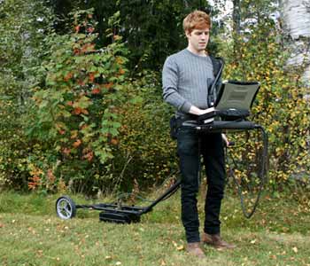
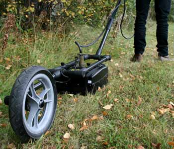
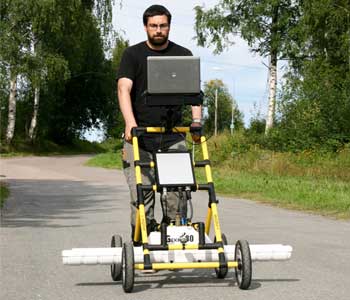
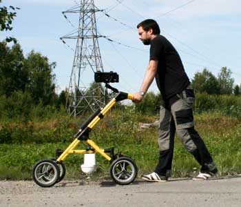
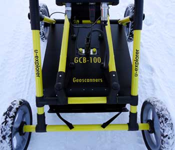
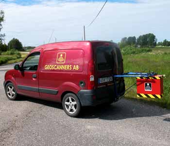
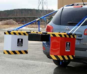
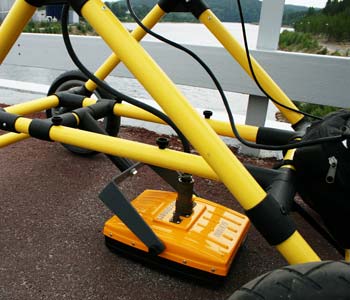
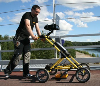
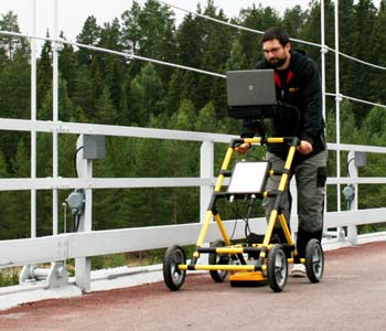
U-Explorer is a complete GPR survey system that has a combination of top of the line Geoscanners products: an Akula 9000 radar control unit, a ground coupled antenna from the GCB-series, GAS acquisition GPR software, GPRSoft post-processing software, a 4-wheel SVC-820 survey cart with an integrated survey wheel, as well as other accessories. Everything is calibrated and matched, so that the system can be used as soon as it arrives. It is an all-in-one scalable survey solution for many different types of surveys focusing on shallow to medium depth investigations. 

How does it work then? U-Explorer has a set of tools that allow the user to accurately find the target objects and determine their depth. The embedded hyperbola fitting tool in the GASacquisition software allows for precise determination of the bulk dielectric constant of the layer under investigation. In other words, a hyperbola appears on the computer screen when the system passes over a target. Moving the system backwards will start the back-up cursor and you will know, when the cursor is right on top of the hyperbola apex, that the center of the antenna is exactly on top or your target. 

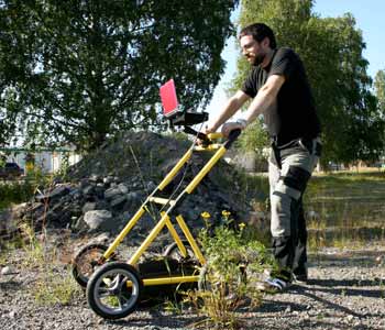
U-Explorer is one of our most popular systems, and there is a reason for it! It can be used for a great variety of different surveys, see the application list on the right for more information. It is also the system that can be adjusted the most to the end user. This is because it is designed with scalability in mind, allowing you to choose the perfect antenna or other accessories upon discussing your survey requirements with our engineers. The choice of antenna will not affect the price of the system, but it will make your survey results reach a whole new level.

Applications


  • Utility detection and mapping
  • Void detection
  • Environmental damage location
  • Forensic investigations
  • Archeology

Complete Survey Systems

/ U-Explorer Mini

Overview

U-Explorer Mini is very similar to the U-Explorer ground penetrating radar system. Both are scalable survey solutions equipped with an Akula 9000 control unit, a fully shielded ground coupled GCB antenna, GPRSoft post-processing software and GAS acquisition software. The main difference between the two systems is that U-Explorer Mini has a smaller SVC-821 2-wheel cart instead of the SVC-820 4-wheel cart. 

U-Explorer Mini has two major benefits compared to larger systems. To begin with, due to the smaller cart, the complete system (excluding the included laptop) can be packed inside a regular 20kg suitcase. This is a huge relief for people who rely on air transportation, because it allows the freedom to pack the unit as GPR operator baggage and use airplanes without any trouble. The second, more obvious benefit, is that the 2-wheel SVC-821 allows the antenna to reach closer to possible obstacles on the surface. If surveying an area close to walls and buildings, this gives you additional information from the materials and objects right next to the foundations of your obstacle. 

Just as with the U-Explorer system, the U-Explorer Mini system can be adjusted, allowing you to choose the perfect antenna or other accessories upon discussing your survey requirements with our engineers. The choice of antenna will not affect the price of the system. As a last note, if you already have a U-Explorer, then you can easily switch to the Mini version or vice versa. The only difference is the cart, but that small difference can have a major effect on the survey results.

Applications

​​​​​​​

  • Utility detection and mapping
  • Void detection
  • Environmental damage location
  • Forensic investigations
  • Archeology
  • bnr_Scorpio02.jpg
  • bnr_Scorpio01.jpg

Complete Survey Systems

/ Scorpio

Overview

Scorpio is a complete GPR survey solution designed specifically for rough terrains. It consists of premium Geoscanners products: an Akula 9000 radar control unit, a ground coupled GCBantenna, intuitive GPRSoft post-processing and GAS acquisition software, a GSH-490 rough terrain survey tow handle, as well as other accessories. Everything is calibrated and matched, so that the system can be used as soon as it arrives. 

Time efficiency and good results are two important factors in everyday work. That is why you will be delighted to know that the data of superior quality can be obtained right in the field during your survey (just as with the rest of the Geoscanners survey systems). The adaptable GSH-490 tow handle, with an integrated survey wheel, easily follows the uneven surface terrain changes. The small width profile and ease of handling the GPR system allows the operator to pass even through heavy underbrush or steep slope terrain, focusing on the movement and the data collected. 

As with all of Geoscanners systems, Scorpio is a highly scalable system, where the antenna choice does not affect the final price of the system. The system can be adjusted to your specific survey upon a quick consultation with our engineers.

Applications


  • Rough terrain utility detection and mapping
  • Void detection in rough terrains
  • Environmental damage location
  • Forensic investigations
  • Archeology
  • bnr_Pil02.jpg
  • bnr_Pil03 (1).jpg

Complete Survey Systems

/ PiL

Overview

PiL is a unique and user-friendly ground penetrating radar system in the manner that all of its components were developed and manufactured only for PiL. It has its own radar control unit integrated with the GPR antenna, its own unique cart and software. The user interface of the dedicated software allows for quick application in the field. PiL is designed to make the surveying process a simple and quick task with straightforward user control. Because of this the cart also received extra care from our design team, resulting in a quick folding solution that requires little space. 

Some users, and surveys they undertake, benefit from a simple system that does its work without sacrificing the results. Although the customers usually prefer the scalability and fine control of the other Geoscanners GPR system, more direct surveys and less experienced operators can find too many options to be overwhelming. For those cases PiL is the perfect survey solution. It includes the most important functions and produces high quality data. 

The PiL survey solution is straight-forward, quick and ready to be used as soon as it arrives. You will be pleased with the simplicity of usage and the good quality results as expected from all Geoscanners GPR equipment.

Applications

​​​​​​​

  • Utility detection and positioning
  • Void detection
  • Other on-site locating applications
  • bnr_Geo01.jpg
  • bnr_Geo02.jpg
  • bnr_Geo03.jpg

Complete Survey Systems

/ Geo

Overview

The Geo systems are all highly scalable low-frequency GPR systems for deep surveys. The elements were carefully selected and combined to result in compact and easily maneuverable solution for customers doing geology mapping with profile lengths of considerable magnitude. Nevertheless, the systems can be used for other fields of application as long your desired depths of penetration are high and the estimated size of the objects is large enough. 

The Geo series is unique compared to other similar systems in the sense that you will have to look twice to grasp how compact the systems are. The Geo-100D, for example, uses a standard SVC-820 cart and a GCB-100 ground coupled antenna, the smallest 100MHz antenna on the market. Smallest, but by no means performance impaired, on the contrary! The data collected with the Geo-100D can be analyzed directly on the field using the GPRSoft post-processing software that is included in the system. The table below shows the different Geo system configurations. 

Depending on the survey requirements, different low frequency antennas from our product line are ready to be used and insure highest performance possible. In order to choose the perfect Geo system for your survey requirements, we would recommend a consultation with our engineers. It is a quick process that is of great help if you know that you need a low frequency antenna, but not sure which Geo system is the best fit for your survey requirements best.

Applications

​​​​​​​

  • Deep utility surveys
  • Deep stratigraphic mapping
  • Deep archeology surveys
  • Deep forensics
  • Deep water table surveys
  • Deep void detection
  • bnr_Rex01.jpg
  • bnr_Rex02 (1).jpg

Complete Survey Systems

/ Rex

Overview

Rex (Road Explorer) is a complete GPR solution for high speed road and railroad surveys. The Rex systems are mounted on vehicles and use airborne antennas to avoid the friction in contact with the road, allowing for considerable speeds of acquisition. Rex series solutions provide single channel (Rex), dual channel (Rex Duo) and triple channel (Rex Triton) antenna combinations to satisfy the surveying requirements in the best possible way. 

All Rex systems include a control unit from the well established Akula 9000 series, an airborne antenna from the HA horn antenna series and/or the FLB antenna series. In cases where more than one antenna is required (Rex Duo and Rex Triton), the antennas are combined, using a MCE multiplexer, to guarantee the best possible results. The data is collected and processed on a laptop with pre-installed GPRSoft post-processing and GAS acquisition software. In order to find the perfect antenna configuration for your survey requirements, we would recommend a brief consultation with our experienced GPR engineers.

Applications

​​​​​​​

  • High speed road surveys
  • High speed railroad surveys
  • High speed airport lanes inspection
  • bnr_odin01.jpg
  • bnr_odin02.jpg
  • bnr_odin03.jpg

Complete Survey Systems

/ Odin

Overview

The Odin GPR survey system was designed for shallow surface applications that focus on small targets and require the best possible resolution. To achieve this, the Odin systems use the high-end capabilities of the Akula 9000 control units, high frequency antennas from the GCB-series and a selection of customized accessories. It is simple to switch to Odin from another system, U-Explorer for example, because the systems are highly scalable. Both use the same SVC-820 carts, many similar accessories and control unit (unless an Akula 9000C is required). This gives the GPR operators a freedom of having access to many different systems without needing to own a large storage department. 

The Odin systems provide excellent resolution in shallow areas, which is what the system is aimed for. The level of detail depends on the included antenna, but the common factor in all Odin systems is that the targets will be easily and quickly detected. There are three different Odin systems, depending on the depth and resolution needs of the survey. The table below shows the differences in more detail, but please do not hesitate to contact our support engineers to help you choose the perfect system configuration for your survey requirements.

Applications


  • Rebar inspection
  • Low speed road and bridge assessment surveys
  • Concrete inspection
  • Ice thickness
  • Shallow utility survey

Contact us for more

products and updates